West of Pacific Coast Highway

Overview for West of Pacific Coast Highway, CA

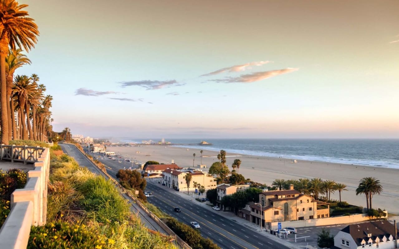
36,409 people live in West of Pacific Coast Highway, where the median age is 44.6 and the average individual income is $73,909. Data provided by the U.S. Census Bureau.

36,409

Total Population

44.6 years

Median Age

High

Population Density Population Density This is the number of people per square mile in a neighborhood.

$73,909

Average individual Income

Demographics and Employment Data for West of Pacific Coast Highway, CA

West of Pacific Coast Highway has 16,590 households, with an average household size of 2.16. Data provided by the U.S. Census Bureau. Here’s what the people living in West of Pacific Coast Highway do for work — and how long it takes them to get there. Data provided by the U.S. Census Bureau. 36,409 people call West of Pacific Coast Highway home. The population density is 10,172.41 and the largest age group is Data provided by the U.S. Census Bureau.

36,409

Total Population

High

Population Density Population Density This is the number of people per square mile in a neighborhood.

44.6

Median Age

49.88 / 50.12%

Men vs Women

Population by Age Group

0-9:

0-9 Years

10-17:

10-17 Years

18-24:

18-24 Years

25-64:

25-64 Years

65-74:

65-74 Years

75+:

75+ Years

Education Level

  • Less Than 9th Grade
  • High School Degree
  • Associate Degree
  • Bachelor Degree
  • Graduate Degree
16,590

Total Households

2.16

Average Household Size

$73,909

Average individual Income

Households with Children

With Children:

Without Children:

Marital Status

Married
Single
Divorced
Separated

Blue vs White Collar Workers

Blue Collar:

White Collar:

Commute Time

0 to 14 Minutes
15 to 29 Minutes
30 to 59 Minutes
60+ Minutes

Schools in West of Pacific Coast Highway, CA

All ()
Primary Schools ()
Middle Schools ()
High Schools ()
Mixed Schools ()
The following schools are within or nearby West of Pacific Coast Highway. The rating and statistics can serve as a starting point to make baseline comparisons on the right schools for your family. Data provided by the U.S. Census Bureau.
Type
Name
Category
Grades
School rating
Beryl Heights Elementary
PUBLIC
K - 5th
5/5
Parras (Nick G.) Middle
PUBLIC
6th - 8th
5/5
PUBLIC
K - 5th
5/5
St Lawrence Martyr Elementary School
PRIVATE
K - 8th
No rating available
Montessori School Peninsula
PRIVATE
PreK - K
No rating available
PRIVATE
PreK - 1st
No rating available
Riviera Hall Lutheran School
PRIVATE
PreK - 8th
No rating available
Peninsula Montessori School
PRIVATE
PreK - 5th
No rating available
PUBLIC
K - 5th
5/5
PUBLIC
9th - 12th
4/5
Patricia Dreizler Continuation High
PUBLIC
9th - 12th
1/5
Redondo Beach Learning Academy
PUBLIC
9th - 12th
No rating available

Around West of Pacific Coast Highway, CA

There's plenty to do around West of Pacific Coast Highway, including shopping, dining, nightlife, parks, and more. Data provided by Walk Score and Yelp.

83
Very Walkable
Walking Score
84
Very Bikeable
Bike Score

Points of Interest

Explore popular things to do in the area, including Ka Huelo Bakery, Masarap Cafe, and Sand and Surf Soccer Club.

Name Category Distance Reviews
Ratings by Yelp
Dining 2.5 miles 15 reviews 5/5 stars
Dining 4.12 miles 6 reviews 5/5 stars
Active 4.2 miles 6 reviews 5/5 stars
Active 4.77 miles 19 reviews 5/5 stars
Active 3.16 miles 29 reviews 5/5 stars
Active 2.04 miles 5 reviews 5/5 stars

West of PCH – (Area 157)

South Redondo MLS areas are fairly easy to follow. The three major dividing lines are Pacific Coast Highway (PCH), Torrance Blvd., and Palos Verdes Blvd. Properties located on the west side of the highway are in area 157, simply dubbed “West of PCH”. Within area 157, there are five distinct sub-sections.

THE ESPLANADE – Beginning one block south of Veteran’s Park, where Pearl St. crosses Catalina Ave. is a street called “The Esplanade” which is Redondo Beach’s “Strand”. The Esplanade runs along the cliff that leads down to the sands of Redondo’s beaches. Much of this area was once the site of the Hotel Redondo, the sister hotel to the famed Hotel del Coronado in San Diego. The Hotel Redondo was demolished in 1925. Veteran’s Park next to The Pier was once a part of the Hotel Redondo grounds. Today this area now begins with a stretch of hi-rise condominium developments that date to the 1970s. As you head south, the zoning changes and the condos give way to larger privately owned lots which feature traditional single family homes. About where Knob Hill Ave. meets The Esplanade is where zoning once again changes.

One block south of Knob Hill Ave. is where The Avenues begin. At Avenue A, oceanfront properties cease and the public walk-way begins. From Ave A south, homes sit on the east side of The Esplanade, overlooking the public walkway with unblockable views of the ocean. Here, a mix of apartments, condos, townhomes and a few single-family homes enjoy incredible views while also being within walking distance of all the community activity in nearby Riviera Village. Locals enjoy walking and/or riding bikes along this strip of oceanfront land, as it is very common to catch dolphins playing in the surf as well as sighting whales cruising along their seasonal migration route. The Esplanade terminates south at Miramar Park (also known as “Dolphin Park”) where it continues on as Paseo de la Playa into a small sub-section known as the “Lower Riviera”. At this convergence point, the beach is now locally referred to as “RAT Beach” (Right at Torrance). This is where the beach gives way to a small strip owned by the City of Torrance.

THE LOWER AVENUES – From Avenue A south through Avenue I, where “The Village” begins, is a small area of flat avenues that lie between PCH and Catalina Ave. Homes in the Lower Avenues are largely single-family homes. Some duplexes can be found here and many of the smaller, original SFRs (single-family residences) offer detached ADU structures (accessory dwelling units). Residents enjoy larger lots, space between neighbors and a short walk to the beach and the Village. The lifestyle here is so sought after that homes rarely go on the market and when they do, they usually turn quickly.

THE LOWER RIVIERA – Where The Esplanade gives way to Calle Miramar and Paseo de la Playa at the round-about, there is a small area bordered by Catalina Ave., Palos Verdes Blvd. and Paseo de la Playa called the “Lower Riviera”. Locals also like to dub this area “The Riv”. The draw here is the proximity to the beach, The Village and the lower part of the Palos Verdes hill. Most homes are SFRs that sit on larger than typical lots for the proximity to the beach. Many homes enjoy sweeping views of the ocean that stretch as far as the Pacific Palisades. There are numerous streets ending in cul-de-sacs, which limits thru-traffic. Residents enjoy that “park-and-walk-everywhere” ocean-view lifestyle at a significant value over traditional “Sand Section” living in neighboring Manhattan Beach and Hermosa Beach. The Riviera Village is a huge draw for nearby residents. It is a popular hub of South Redondo community events, boutique shopping and dining options, and daily conveniences.

THE PIER – On the north side of Torrance Blvd. in area 157, homes in this sub-section are in the area close to the Redondo Pier. This small section west of PCH begins at Torrance Blvd. and ends at Beryl St. There is a great mix of SFRs, townhomes, condos and duplexes which gives way to a neighborhood full of charm and character. Many lovingly restored, historic, turn-of-the-century homes can still be found in this section. Historic homes that meet the criteria of the Mills Act benefit largely from a rare tax code at a significant savings. Residents can easily walk to the Pier area to enjoy regular events, such as summertime concerts, free yoga, community movie nights, the Farmer’s Market, and the annual Kite Festival. Redondo Beach is also the host of the beach cities Fourth of July fireworks show. Many locals start their 4th of July tradition by participating in the Village Runner 5k race in the Village that morning, then enjoying the fireworks later at Seaside Lagoon.

THE MARINA – West of PCH, North of Beryl St., terminating at Herondo St. (at the border of Hermosa Beach) is the smallest subsection of area 157. Here is where residential zoning largely gives way to commercial zoning. Residents can easily walk to events, recreational options and waterfront dining along the King Harbor marina zone. 2019 marked the successful launch of the first annual Beach Life Festival, a landmark event that transformed the area just north of The Pier to Seaside Lagoon into a 3-day festival celebrating beach life through music. Other local favorites are the Holiday Boat Parade hosted by the King Harbor Yacht Club and the ever popular Superbowl 5k/10k fun run with a course that tours The Marina area.


Home Search


Available Listings in the Area

let's talk

You’ve got questions and we can’t wait to answer them.